LDARSim Canada - Gas Leak Detection and Simulation Platform
- Published on
- Duration
- 9 Months
- Role
- Full-Stack Developer (Frontend & Backend)
- Atmosphere
- Data-Driven & Collaborative
- Technology
- Django, Celery, Redis, MongoDB, PostgreSQL, PostGIS, QGIS, Dropbox API, Google Drive API
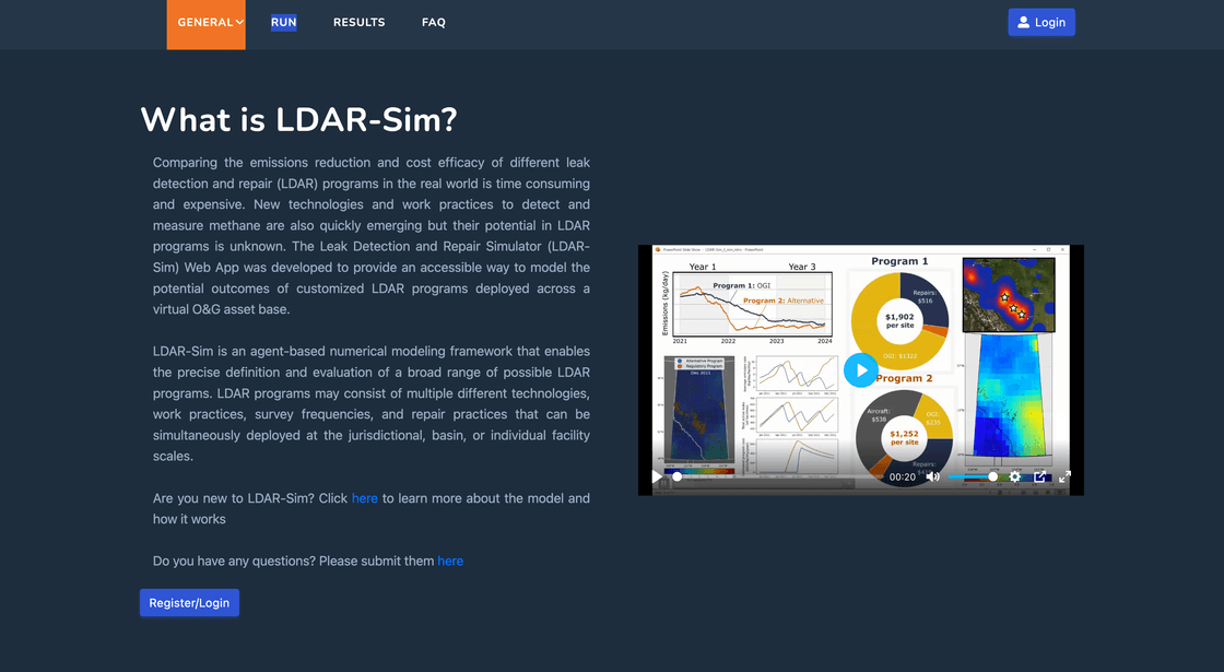
Project Overview
I developed LDARSim Canada, a platform designed to collect, process, and simulate gas leak detection data from trucks, cars, and drones equipped with advanced sensors (e.g., methane (CH4) and other gas sensors). These vehicles operate in the oil and gas industry areas of Canada, collecting vast amounts of leak data. At the end of each day, drivers upload the data to Dropbox and Google Drive. Our platform retrieves this data, processes it using high-speed libraries, and stores it in a database for further analysis.
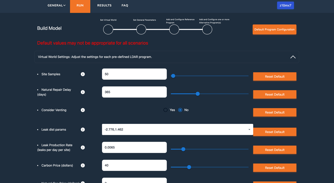
The platform provides a web-based GUI for users and data scientists to run simulations with customizable parameters. Additionally, we developed a QGIS plugin to integrate gas leak data with geospatial analysis tools.
Key Features
Data Collection and Upload:
- Trucks, cars, and drones collect gas leak data using methane (CH4) and other sensors.
- Drivers upload data to Dropbox and Google Drive at the end of each day.
High-Speed Data Processing:
- The platform retrieves data from cloud storage and processes it using high-speed libraries.
- Data is stored in PostgreSQL (with PostGIS for geospatial data) and MongoDB for unstructured data.
Web-Based Simulation GUI:
- Users and data scientists can run simulations with customizable parameters.
- Simulations are executed in the background using Celery and Redis for task queuing.
- Results are displayed in real-time on the web-based GUI.
QGIS Plugin:
- Developed a QGIS plugin to integrate gas leak data with geospatial analysis tools.
- Enables users to visualize and analyze data directly within QGIS.
Real-Time Data Visualization:
- Provides interactive dashboards for visualizing gas leak data and simulation results.
- Supports filtering, sorting, and exporting data for further analysis.
Scalable Backend:
- Built with Django for robust API development and Celery for asynchronous task processing.
- Uses Redis for task queuing and caching.
Cloud Integration:
- Integrates with Dropbox and Google Drive APIs for seamless data retrieval.
- Stores processed data in AWS S3 for scalable storage.
CI/CD Pipeline:
- Implemented Buddy for automated testing and deployment.
- Ensures smooth and efficient development workflows.
Self-Managed Infrastructure:
- Managed servers and deployment environments independently.
- Utilized Docker for containerization and deployment.
Technology Stack
Backend:
- Django: For building robust and scalable APIs.
- Celery: For asynchronous task processing.
- Redis: For task queuing and caching.
- PostgreSQL: Primary database for structured data.
- PostGIS: For geospatial data storage and analysis.
- MongoDB: Secondary database for unstructured data.
- Dropbox API: For retrieving uploaded data.
- Google Drive API: For retrieving uploaded data.
Frontend:
- React: For building interactive user interfaces.
- Next.js: Server-side rendering and routing.
- TailwindCSS: Utility-first CSS framework for styling.
- Redux: State management for complex frontend logic.
- DaisyUI: Component library for building responsive UIs.
DevOps:
- Buddy: CI/CD pipeline for automated testing and deployment.
- Docker: Containerization for consistent environments.
- Self-Managed Servers: Handled server setup, scaling, and maintenance.
Geospatial Integration:
- QGIS Plugin: For integrating gas leak data with geospatial analysis tools.
Challenges and Solutions
Handling Large Data Volumes:
- Challenge: Processing and storing large volumes of gas leak data efficiently.
- Solution: Used high-speed libraries for data processing and PostgreSQL with PostGIS for optimized storage.
Real-Time Simulation:
- Challenge: Running simulations with customizable parameters in real-time.
- Solution: Implemented Celery and Redis for background task processing and real-time updates.
QGIS Integration:
- Challenge: Integrating gas leak data with QGIS for geospatial analysis.
- Solution: Developed a custom QGIS plugin to seamlessly import and visualize data.
Cloud Storage Integration:
- Challenge: Retrieving data from multiple cloud storage providers (Dropbox and Google Drive).
- Solution: Integrated Dropbox API and Google Drive API for automated data retrieval.
Outcome
LDARSim Canada has revolutionized gas leak detection and simulation in the oil and gas industry. It provides a seamless workflow for data collection, processing, and analysis, enabling users to run simulations and visualize results in real-time. The QGIS plugin further enhances its utility by integrating gas leak data with geospatial tools.